
From Terra-Forming to Earth Art - A History of Bluestone from 400 Million Years Ago to the Present
|
Some of these creations are sensuous, ever changing experiments of light, texture, sound and aroma. We and all "living" things around us are part of this ephemeral side of the earth's creativity.
At the end of the forest experiment a dead land, no longer held by the forest's roots, washed down to cover these scorched sands. After tens-of-millions of years a two mile thick layer compressed the sands at the bottom of a deep sea. Heat from this pressure and the depths worked upon the sands scorched and crystalline elements, chemically merging them with properties of the limestone bed of the ancient sea. The result became the massive, 500 foot-thick monolithic plate of dense dark sandstone we know as Bluestone. The process yielding its organic bonding and color involving intense pressure from both above and below following the period of its formation during the earliest in the evolution of forests make Bluestone a product of nature that is incomparable and in a way mysterious. Over the next hundreds of millions of years this plate was lifted from the depths under the drifting action of the Appalachian and Acadian land masses. Unable to push this Bluestone plate and its two-mile thick burden forward, they pressed under instead, eventually forcing this land mass three miles high at its eastern front. Over millions of years of exposure this mountain eroded west to make the continental plateau and east down the Hudson River. In time the easterly In his long union with these ledges man developed a spiritual connection with their plated structure. They represented a symbol of the Earth which he likened to the form of the shell of the turtle. He lived in harmony with this symbol. He was a life this turtle bore on its back. The other life forms there were what the earth gave him to fill his needs. He moved not one stone from these ageless ledges lest that harmony be disturbed. Four hundred years ago Henry Hudson met these native peoples and in recording the resources he found on their lands wrote of the "great store of slate for houses, and other good stones". Within a score of years stone houses began to be built by the Dutch settlers from "cliff stone", the dimensional fragments fallen to the base of the ledges, and at the same time the native people, the Warranawonkongs, disappeared.
Picking through these naturally found flat stones would lead to the founding of an industry for quarrying and finishing perfectly dimensioned stone slabs. This began in 1831 when Silas Brainard was hired to build a bridge in the newly incorporated Village of Ulster, now Saugerties Village. The Woodstock and Saugerties turnpike was being constructed at this time and he discovered that above Veteran where the turnpike zigzagged its way up the Hoogeberg ridge there was readily accessible the quality of stone he needed for building the bank abutments to support his bridge. A house on the vanValkenberg farm was constructed of perfectly dimensioned blue sandstone. The ledge that supplied this stone became the site of the first commercial Bluestone quarry. Within 30 years the quarrying industry had grown to involve over half the land mass of Saugerties.
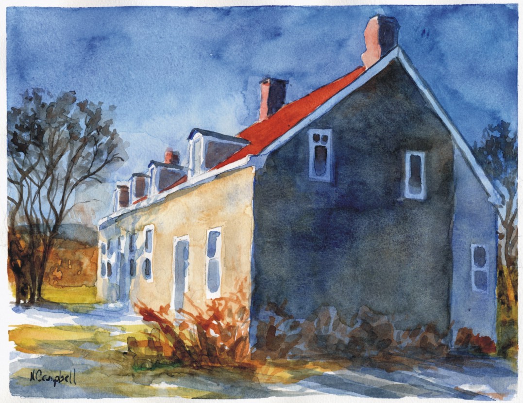
Before modern man arrived only the earth had the power to change this landform. For thousands of years the native inhabitants of the Saugerties region tightly stacked their burial cairns of its stone only to ritually remove it and return it to its natural place once the body inside had been returned to the earth. They were an integral part of this land and they left no permanent marker on it. The Europeans that replaced them had the opposite use for stone. It raised them above the earth and allowed them a sense of permanence. The permanence of their stone houses made these "landmarks" and they remain period markers of Saugerties' early recorded history. This history follows the land. The first stone houses set their foundations into bedrock ledges and raised their walls to match the slope. These are bank houses. They were located over a spring of water that the house enclosed for winter use. They were the houses of herdsmen as the pastureland of the earliest settlement, Kingston, spread northward. Stone houses were also built along the major wagon roads and by-ways. These are different. They are built on the ground plain and made large enough to act as way-stations and frontier garrisons as well as shelters for the farming family they housed. The period of greatest activity in stone house building in Saugerties follows the competitive growth of agriculture. This coincided with the disbursement of the largest immigration of the time, the West Camp Palatines, after 1712. Prior to their homesteads most of Saugerties was frontier. Before and after the Revolution their stone houses showcased the growing prosperity of remote farms well into the interior. |
The "stone dwelling house" named in the 1834 deed from William VanValkenberg, its builder, to Silas Brainard, the bridge builder who is historically credited with operating the first commercial bluestone quarry, is a perfect example. This is a house crafted of stone extracted from a nearby ledge rather than from stone found at its base. Its survival shows that bluestone was quarried to take advantage of its working properties before it became a commodity for a market that the naturally formed 2" thick rifts in its structure were uniquely suited for: sidewalk stones. By the 1870's thousands of miles of sidewalks in nearly every large city in America had been covered with "slate" quarried from every exposure of Bluestone ledge that could be found along the eastern escarpment of the Catskill Mountains. This was known as North River Bluestone after its shipping location on the North (Hudson) River.
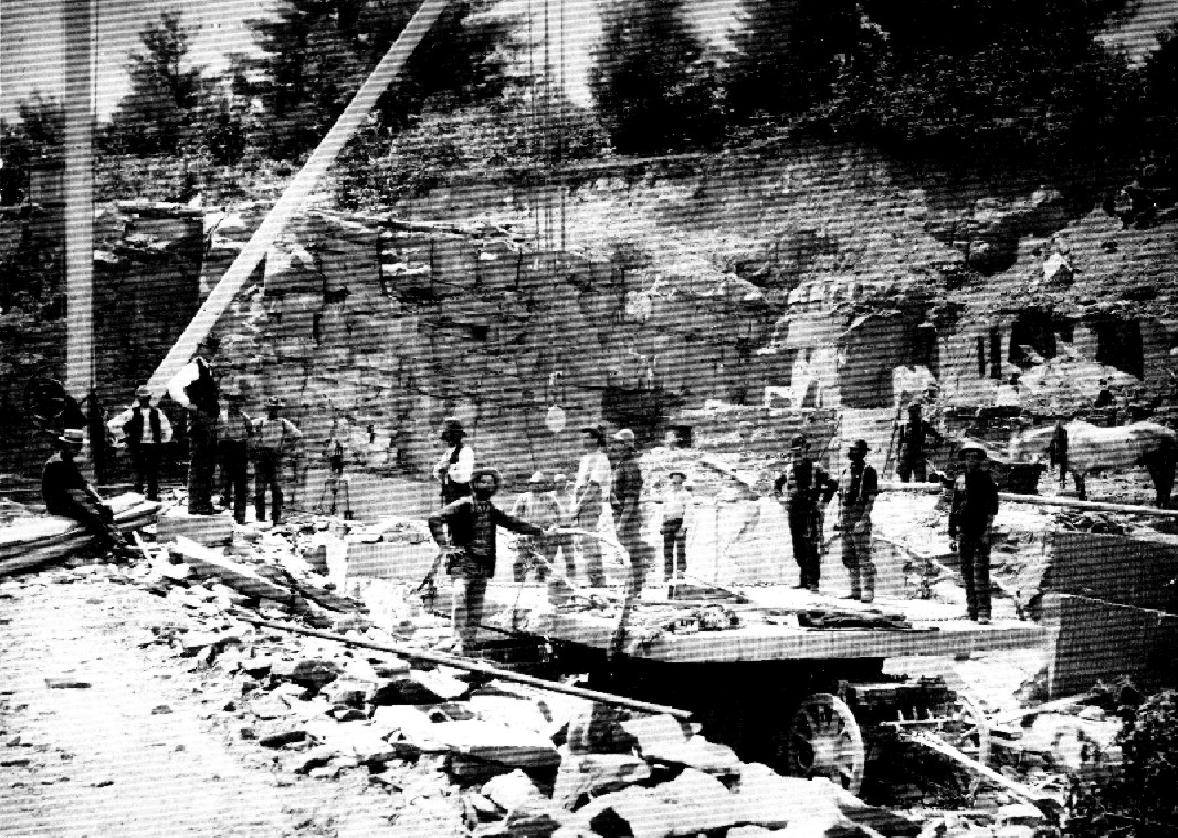
They inaugurated a tradition of skill that would spread throughout the Catskill foothills and would last for well over a century. In slices of an inch-and-a-half they peeled their way through the solid rock hill of this first quarry, changing the course of streams from south to north, making a wide pass between the Plattekill and the Beaverkill that would be known as Russell's Clove. They had begun an equal change to the north through the productive headwater feeders of the Beaverkill when Quarryville opened their attention to its even more productive seams.
Bluestone quarrying was an early form of the 1849 gold rush. Shanty towns sprang up around the quarry sites mostly occupied by Irish workers already skilled in hard rock mining as laborers on the Erie Canal. They would later use their skills in the iron mines of Minnesota, the silver mines of Colorado and the gold mines of California but they would make their first small fortune in Saugerties. These were the skilled workers that made Bluestone quarrying into an industry. Large fortunes were made from Bluestone before and after the Civil War. The largest were made in Saugerties. Its quarries were closest to the river ports with their finishing yards and merchants. Transporting a slab to the docks may cost only 8% of its value in Saugerties as opposed to as much as 30% if the quarry were in the hills of Hurley or Woodstock. This transportation created fortunes for the owners of the toll roads to Glasco, Malden and Saugerties Village over which a steady, almost non-stop train of "Bluestone Boats" passed each other to and from the docks. These roads were specially improved to carry the great weight of the Bluestone. Grooved rails called Belgian Bridges were laid the length of the turnpikes to prevent the wheels from sinking deep into the roadbed under the heavy loads. Not all the quarried stone went to the Bluestone docks. Some of the larger pieces from the quarries that were unmarketable as slabs were dressed for building the many cut stone houses, outbuildings and walls that are found in the areas where the first quarries were started. Cut stone houses are found near the quarries in Pine Grove, Veteran, above Fishcreek on Old Echo Hill Road and in High Woods both north and south of the Glasco Turnpike. These date from the very earliest stage of quarry development. They testify to the skill of the stone cutters at the quarries and the value placed by the owners on the quarries themselves by their building these estate houses of the period so near to their quarrying operations. The largest by far estate house built entirely of cut bluestone is the mansion house of James O. Winston, the engineer of the dams at the great Ashokan Reservoir. This is situated less than a mile from where the first bluestone quarrying began in 1831. The property on which the house is built was bought after the completion of the Ashokan project in 1914 and the mansion house was probably completed after 1921 as a final enlargement to an ancient stone house occupying this site for over a hundred years. Winston's house is a monument to a man that may have been the very last of the great quarry operators. The Yale Quarry at the Ashokan Reservoir encompassed an original 4 acres and adjacent lands just to the southwest of the great dam being built over the Esopus. From the day the project began in 1907 to the last with the building of the great fountain aerators and the administration buildings in 1914, Winston & Company continually extracted and dressed bluestone from the Yale Quarry. Some of the last Bluestone commercially quarried in Saugerties was from the York quarry in the 1930's and used for the facing stone and the columns of Rockefeller Center. This was done during the depression when the National Youth Administration also attempted to promote the learning of quarrying skills and building and carving with stone. Some related WPA projects such as Bluestone arch bridges, roadside retaining walls and the NYA buildings that became those of the Art Students League in Woodstock were the last major applications of Bluestone.
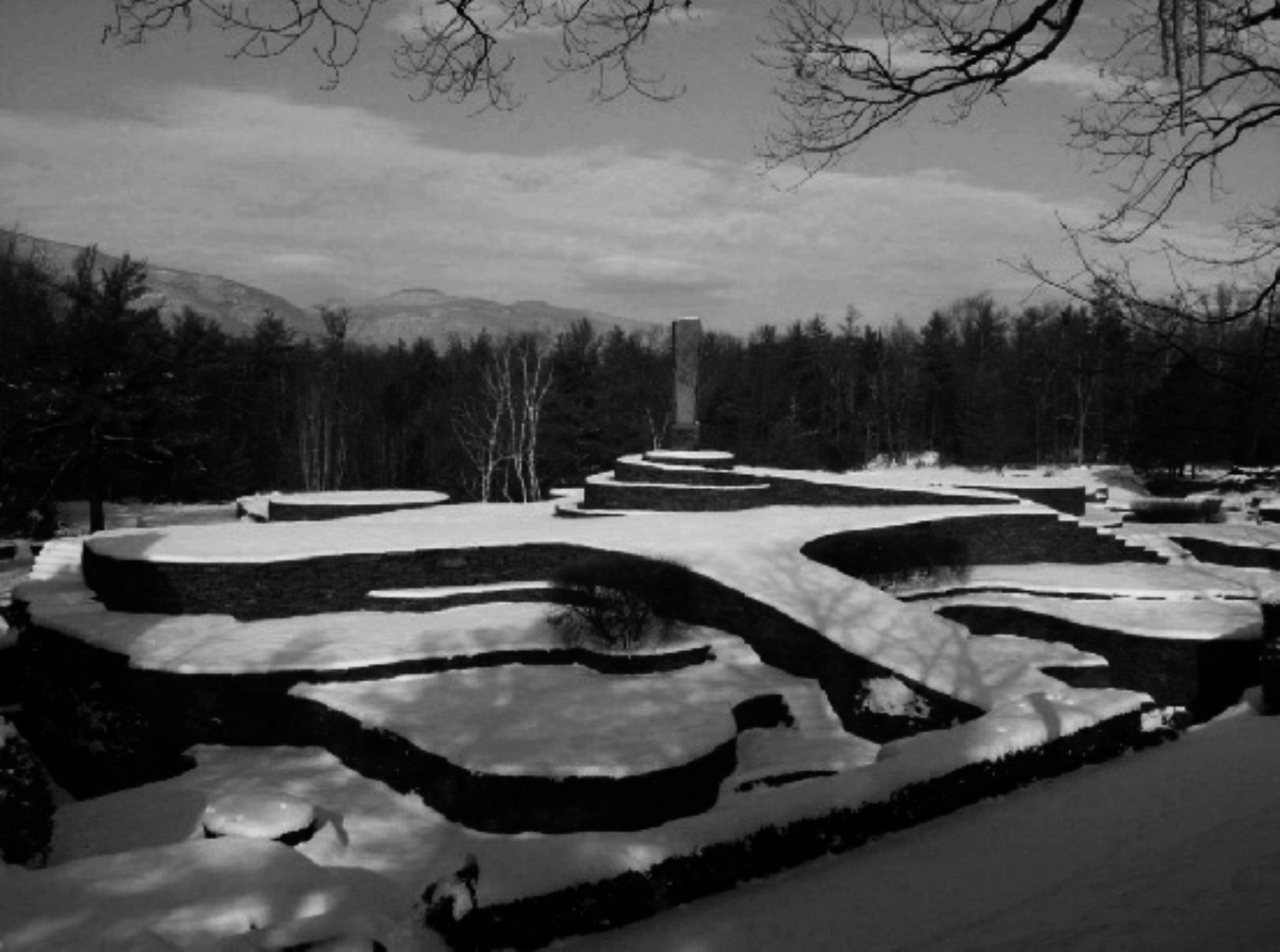
This has had an economic impact. None of the acreage of the abandoned Bluestone quarries so deeply cut into the bedrock can be made to satisfy the drainage requirements of the health code for building a residence. Since this is currently the principal means of valuing land in the Town thousands of rural acres are removed from being economically productive. This essentially guarantees that Saugerties must retain these quarried lands as open spaces for ages to come. These lands still have important uses. They have cultural value in their industrial archaeology significance. They are also a window into the history of the planet for the study of geology because they form a slice into the millions of years it took to accumulate the hundreds of feet of sediment forming the material eventually compressed into the monolithic 500 foot thick Bluestone plate upon which most of the east continental plateau of the United States resides. But the use that can realize the highest economic impact for Saugerties follows the example of Opus 40, the environmental sculpture of Harvey Fite. As sites for sculptural works a whole new dimension is brought to the useful development of these abandoned quarries and the landscape of Saugerties. With art Bluestone can continue to be the once and future soul of Saugerties. |
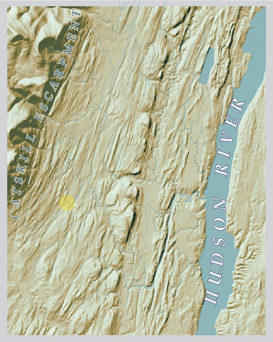
 A copy of Alan McKnight's beautifully descriptive graphic of the geological base of the Town of Saugerties from a 1985 article
written by Spider Barbour on the Geology of the Catskills.
A copy of Alan McKnight's beautifully descriptive graphic of the geological base of the Town of Saugerties from a 1985 article
written by Spider Barbour on the Geology of the Catskills.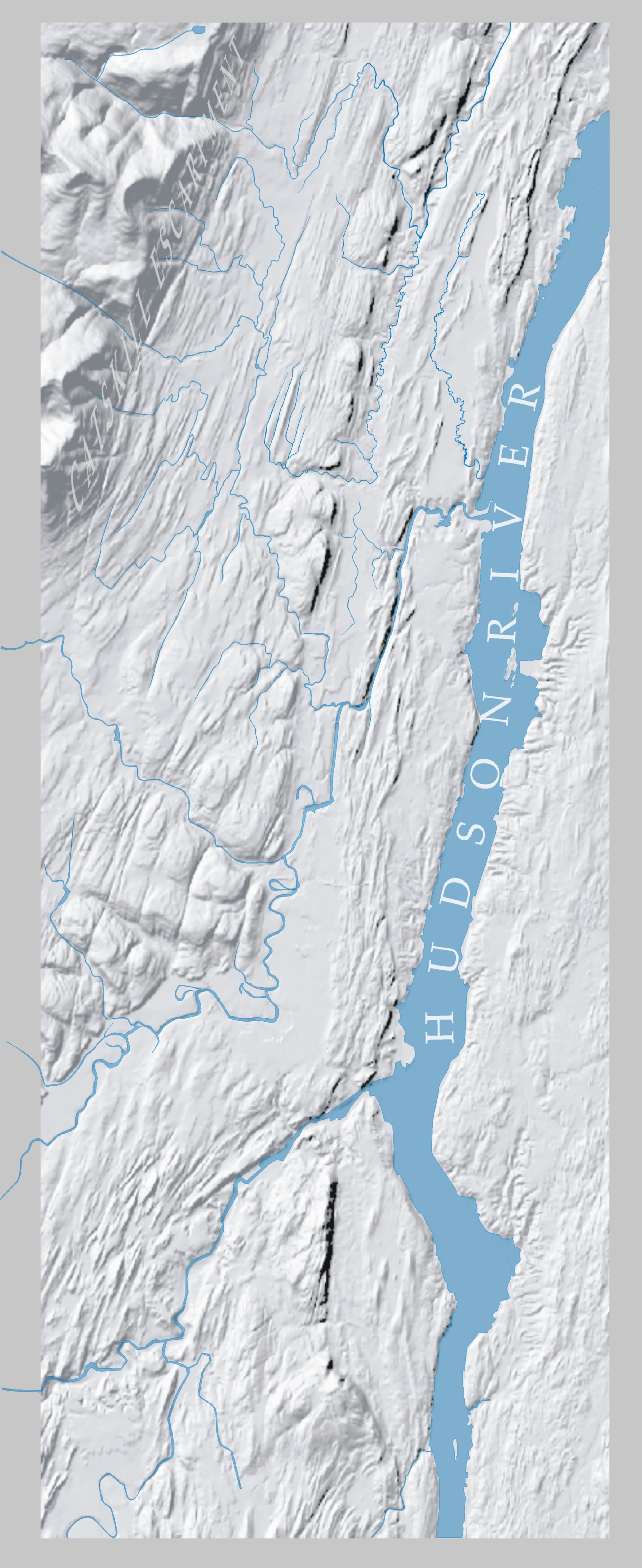
|
|
|
 |
terra firma
1Timeline and Illustrated History
HISTORY EARLY HISTORY THE BOOK
sketches and overviews from all periods of local history with embedded links in context to resources for more comprehensive study
Topic 1
Topic 2
Topic 3
Topic 4
Topic 5
Topic 6
Topic 7
Topic 8
Topic 9
Topic 10
Personal observations on the history and character of Saugerties, New York